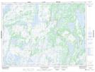
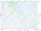
Maps showing Steele Pond, Burgeo-Bay d'Espoir, Newfoundland and Labrador
Steele Pond is a Lake located in Burgeo-Bay d'Espoir, Newfoundland and Labrador and has an elevation of 286 meters.
- Latitude: 48° 8' 6'' North (decimal: 48.1349998)
- Longitude: 56° 30' 41'' West (decimal: -56.5113888)
- Topography Feature Category: Lake
- Geographical Feature: Pond
- Canadian Province/Territory: Newfoundland and Labrador
- Elevation: 286 meters
- Location: Burgeo-Bay d'Espoir
- Atlas of Canada Locator Map: Steele Pond
- GPS Coordinate Locator Map: Steele Pond Lat/Long
Steele Pond NTS Map Sheets