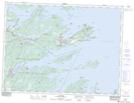
Maps showing Culls Harbour, Bonavista South, Newfoundland and Labrador
Culls Harbour is a Unincorporated area located in Bonavista South, Newfoundland and Labrador and has an elevation of 24 meters.
- Latitude: 48° 40' 47'' North (decimal: 48.6797222)
- Longitude: 53° 56' 56'' West (decimal: -53.9488888)
- Topography Feature Category: Unincorporated area
- Geographical Feature: Settlement
- Canadian Province/Territory: Newfoundland and Labrador
- Elevation: 24 meters
- Location: Bonavista South
- Atlas of Canada Locator Map: Culls Harbour
- GPS Coordinate Locator Map: Culls Harbour Lat/Long