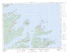
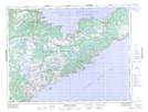
Maps showing Sutherland Bank, Newfoundland and Labrador
Sutherland Bank is a Shoal located in Newfoundland and Labrador.
- Latitude: 49° 45' 0'' North (decimal: 49.7500000)
- Longitude: 55° 42' 57'' West (decimal: -55.7158333)
- Topography Feature Category: Shoal
- Geographical Feature: Bank
- Canadian Province/Territory: Newfoundland and Labrador
- Atlas of Canada Locator Map: Sutherland Bank
- GPS Coordinate Locator Map: Sutherland Bank Lat/Long
Sutherland Bank NTS Map Sheets