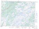
Maps showing McKays Lookout, Harbour Main-Bell Island, Newfoundland and Labrador
McKays Lookout is a Mountain located in Harbour Main-Bell Island, Newfoundland and Labrador and has an elevation of 139 meters.
- Latitude: 47° 14' 43'' North (decimal: 47.2452777)
- Longitude: 53° 14' 20'' West (decimal: -53.2388888)
- Topography Feature Category: Mountain
- Geographical Feature: Lookout
- Canadian Province/Territory: Newfoundland and Labrador
- Elevation: 139 meters
- Location: Harbour Main-Bell Island
- Atlas of Canada Locator Map: McKays Lookout
- GPS Coordinate Locator Map: McKays Lookout Lat/Long
McKays Lookout NTS Map Sheets