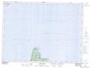
Maps showing Schoolhouse Point, St. John's East Extern, Newfoundland and Labrador
Schoolhouse Point is a Cape located in St. John's East Extern, Newfoundland and Labrador.
- Latitude: 47° 46' 00'' North (decimal: 47.7666666)
- Longitude: 52° 44' 56'' West (decimal: -52.7488888)
- Topography Feature Category: Cape
- Geographical Feature: Point
- Canadian Province/Territory: Newfoundland and Labrador
- Location: St. John's East Extern
- Atlas of Canada Locator Map: Schoolhouse Point
- GPS Coordinate Locator Map: Schoolhouse Point Lat/Long
Schoolhouse Point NTS Map Sheets