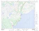
Maps showing L'Anse au Diable Brook, Eagle River, Newfoundland and Labrador
L'Anse au Diable Brook is a River located in Eagle River, Newfoundland and Labrador and has an elevation of 207 meters.
- Latitude: 51° 33' 33'' North (decimal: 51.5591666)
- Longitude: 56° 45' 28'' West (decimal: -56.7577777)
- Topography Feature Category: River
- Geographical Feature: Brook
- Canadian Province/Territory: Newfoundland and Labrador
- Elevation: 207 meters
- Location: Eagle River
- Atlas of Canada Locator Map: L'Anse au Diable Brook
- GPS Coordinate Locator Map: L'Anse au Diable Brook Lat/Long
L'Anse au Diable Brook NTS Map Sheets