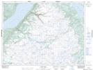
Maps showing Fisher Hills, Humber Valley, Newfoundland and Labrador
Fisher Hills is a Mountain located in Humber Valley, Newfoundland and Labrador and has an elevation of 259 meters.
- Latitude: 48° 58' 21'' North (decimal: 48.9725000)
- Longitude: 57° 27' 56'' West (decimal: -57.4655555)
- Topography Feature Category: Mountain
- Geographical Feature: Hills
- Canadian Province/Territory: Newfoundland and Labrador
- Elevation: 259 meters
- Location: Humber Valley
- Atlas of Canada Locator Map: Fisher Hills
- GPS Coordinate Locator Map: Fisher Hills Lat/Long
Fisher Hills NTS Map Sheets