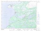
Maps showing Le Malouin, St. Barbe, Newfoundland and Labrador
Le Malouin is a Shoal located in St. Barbe, Newfoundland and Labrador and has an elevation of 5 meters.
- Latitude: 50° 43' 6'' North (decimal: 50.7183333)
- Longitude: 57° 21' 55'' West (decimal: -57.3652777)
- Topography Feature Category: Shoal
- Geographical Feature: Shoal
- Canadian Province/Territory: Newfoundland and Labrador
- Elevation: 5 meters
- Location: St. Barbe
- Atlas of Canada Locator Map: Le Malouin
- GPS Coordinate Locator Map: Le Malouin Lat/Long
Le Malouin NTS Map Sheets