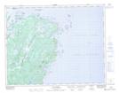
Maps showing Southwest Croque, Strait of Belle Isle, Newfoundland and Labrador
Southwest Croque is a Unincorporated area located in Strait of Belle Isle, Newfoundland and Labrador and has an elevation of 28 meters.
- Latitude: 51° 1' 53'' North (decimal: 51.0313888)
- Longitude: 55° 48' 27'' West (decimal: -55.8074999)
- Topography Feature Category: Unincorporated area
- Geographical Feature: Vacated or Seasonal Settlement
- Canadian Province/Territory: Newfoundland and Labrador
- Elevation: 28 meters
- Location: Strait of Belle Isle
- Atlas of Canada Locator Map: Southwest Croque
- GPS Coordinate Locator Map: Southwest Croque Lat/Long
Southwest Croque NTS Map Sheets