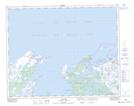
Maps showing Cooks Rocks, Strait of Belle Isle, Newfoundland and Labrador
Cooks Rocks is a Shoal located in Strait of Belle Isle, Newfoundland and Labrador.
- Latitude: 51° 38' 00'' North (decimal: 51.6333333)
- Longitude: 55° 50' 56'' West (decimal: -55.8488888)
- Topography Feature Category: Shoal
- Geographical Feature: Rocks
- Canadian Province/Territory: Newfoundland and Labrador
- Location: Strait of Belle Isle
- Atlas of Canada Locator Map: Cooks Rocks
- GPS Coordinate Locator Map: Cooks Rocks Lat/Long