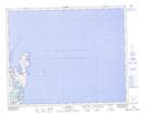
Maps showing Ship Island, Strait of Belle Isle, Newfoundland and Labrador
Ship Island is a Island located in Strait of Belle Isle, Newfoundland and Labrador and has an elevation of 6 meters.
- Latitude: 51° 37' 13'' North (decimal: 51.6202777)
- Longitude: 55° 25' 11'' West (decimal: -55.4197222)
- Topography Feature Category: Island
- Geographical Feature: Island
- Canadian Province/Territory: Newfoundland and Labrador
- Elevation: 6 meters
- Location: Strait of Belle Isle
- Atlas of Canada Locator Map: Ship Island
- GPS Coordinate Locator Map: Ship Island Lat/Long