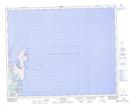
Maps showing Lancy Ball Bay, Strait of Belle Isle, Newfoundland and Labrador
Lancy Ball Bay is a Bay located in Strait of Belle Isle, Newfoundland and Labrador and has an elevation of 7 meters.
- Latitude: 51° 35' 43'' North (decimal: 51.5952777)
- Longitude: 55° 27' 53'' West (decimal: -55.4647222)
- Topography Feature Category: Bay
- Geographical Feature: Bay
- Canadian Province/Territory: Newfoundland and Labrador
- Elevation: 7 meters
- Location: Strait of Belle Isle
- Atlas of Canada Locator Map: Lancy Ball Bay
- GPS Coordinate Locator Map: Lancy Ball Bay Lat/Long