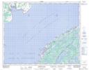
Maps showing Pines Cove, Strait of Belle Isle, Newfoundland and Labrador
Pines Cove is a Unincorporated area located in Strait of Belle Isle, Newfoundland and Labrador and has an elevation of 2 meters.
- Latitude: 51° 22' 0'' North (decimal: 51.3667084)
- Longitude: 56° 35' 57'' West (decimal: -56.5990339)
- Topography Feature Category: Unincorporated area
- Geographical Feature: Settlement
- Canadian Province/Territory: Newfoundland and Labrador
- Elevation: 2 meters
- Location: Strait of Belle Isle
- Atlas of Canada Locator Map: Pines Cove
- GPS Coordinate Locator Map: Pines Cove Lat/Long
Pines Cove NTS Map Sheets