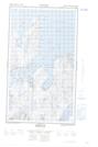
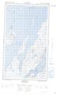
Maps showing Marks Bight Pond, Torngat Mountains, Newfoundland and Labrador
Marks Bight Pond is a Lake located in Torngat Mountains, Newfoundland and Labrador.
- Latitude: 55° 1' 00'' North (decimal: 55.0166666)
- Longitude: 59° 23' 57'' West (decimal: -59.3991666)
- Topography Feature Category: Lake
- Geographical Feature: Pond
- Canadian Province/Territory: Newfoundland and Labrador
- Location: Torngat Mountains
- Atlas of Canada Locator Map: Marks Bight Pond
- GPS Coordinate Locator Map: Marks Bight Pond Lat/Long
Marks Bight Pond NTS Map Sheets