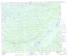
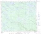
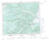
Maps showing Pinus River, Naskaupi, Newfoundland and Labrador
Pinus River is a River located in Naskaupi, Newfoundland and Labrador and has an elevation of 32 meters.
- Latitude: 53° 1' 13'' North (decimal: 53.0202777)
- Longitude: 61° 15' 27'' West (decimal: -61.2574999)
- Topography Feature Category: River
- Geographical Feature: River
- Canadian Province/Territory: Newfoundland and Labrador
- Elevation: 32 meters
- Location: Naskaupi
- Atlas of Canada Locator Map: Pinus River
- GPS Coordinate Locator Map: Pinus River Lat/Long
Pinus River NTS Map Sheets