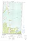
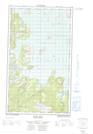
Maps showing Seal Cove Point, Torngat Mountains, Newfoundland and Labrador
Seal Cove Point is a Cape located in Torngat Mountains, Newfoundland and Labrador and has an elevation of 2 meters.
- Latitude: 54° 50' 50'' North (decimal: 54.8470985)
- Longitude: 58° 48' 44'' West (decimal: -58.8121369)
- Topography Feature Category: Cape
- Geographical Feature: Point
- Canadian Province/Territory: Newfoundland and Labrador
- Elevation: 2 meters
- Location: Torngat Mountains
- Atlas of Canada Locator Map: Seal Cove Point
- GPS Coordinate Locator Map: Seal Cove Point Lat/Long
Seal Cove Point NTS Map Sheets