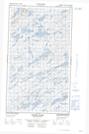
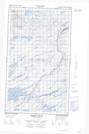
Maps showing Gander Brook, Torngat Mountains, Newfoundland and Labrador
Gander Brook is a River located in Torngat Mountains, Newfoundland and Labrador.
- Latitude: 54° 35' 30'' North (decimal: 54.5916666)
- Longitude: 59° 20' 29'' West (decimal: -59.3413888)
- Topography Feature Category: River
- Geographical Feature: Brook
- Canadian Province/Territory: Newfoundland and Labrador
- Location: Torngat Mountains
- Atlas of Canada Locator Map: Gander Brook
- GPS Coordinate Locator Map: Gander Brook Lat/Long
Gander Brook NTS Map Sheets