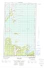
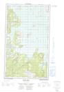
Maps showing Southern Island, Torngat Mountains, Newfoundland and Labrador
Southern Island is a Island located in Torngat Mountains, Newfoundland and Labrador.
- Latitude: 55° 0' 8'' North (decimal: 55.0021459)
- Longitude: 58° 49' 33'' West (decimal: -58.8258537)
- Topography Feature Category: Island
- Geographical Feature: Island
- Canadian Province/Territory: Newfoundland and Labrador
- Location: Torngat Mountains
- Atlas of Canada Locator Map: Southern Island
- GPS Coordinate Locator Map: Southern Island Lat/Long
Southern Island NTS Map Sheets
013J15E Stag Bay Topographic Map at 1:50,000 scale
013J15W Stag Bay Topographic Map at 1:50,000 scale
013O02E Ironbound Islands Topographic Map at 1:50,000 scale
013O02W Ironbound Islands Topographic Map at 1:50,000 scale
013J Rigolet Topographic Map at 1:250,000 scale
013O Makkovik Topographic Map at 1:250,000 scale
013J15W Stag Bay Topographic Map at 1:50,000 scale
013O02E Ironbound Islands Topographic Map at 1:50,000 scale
013O02W Ironbound Islands Topographic Map at 1:50,000 scale
013J Rigolet Topographic Map at 1:250,000 scale
013O Makkovik Topographic Map at 1:250,000 scale