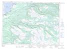
Maps showing Barachois Pond Provincial Park, St. George's, Newfoundland and Labrador
Barachois Pond Provincial Park is a Conservation area located in St. George's, Newfoundland and Labrador and has an elevation of 214 meters.
- Latitude: 48° 28' 20'' North (decimal: 48.4722222)
- Longitude: 58° 15' 11'' West (decimal: -58.2530555)
- Topography Feature Category: Conservation area
- Geographical Feature: Provincial Park
- Canadian Province/Territory: Newfoundland and Labrador
- Elevation: 214 meters
- Location: St. George's
- Atlas of Canada Locator Map: Barachois Pond Provincial Park
- GPS Coordinate Locator Map: Barachois Pond Provincial Park Lat/Long
Barachois Pond Provincial Park NTS Map Sheets