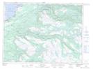
Maps showing Black Bank Provincial Park, St. George's, Newfoundland and Labrador
Black Bank Provincial Park is a Conservation area located in St. George's, Newfoundland and Labrador and has an elevation of 3 meters.
- Latitude: 48° 27' 55'' North (decimal: 48.4652777)
- Longitude: 58° 25' 53'' West (decimal: -58.4313888)
- Topography Feature Category: Conservation area
- Geographical Feature: Provincial Park
- Canadian Province/Territory: Newfoundland and Labrador
- Elevation: 3 meters
- Location: St. George's
- GPS Coordinate Locator Map: Black Bank Provincial Park Lat/Long
Black Bank Provincial Park NTS Map Sheets