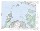
Maps showing Blow Me Down Provincial Park, Bay of Islands, Newfoundland and Labrador
Blow Me Down Provincial Park is a Conservation area located in Bay of Islands, Newfoundland and Labrador and has an elevation of 30 meters.
- Latitude: 49° 5' 28'' North (decimal: 49.0911111)
- Longitude: 58° 21' 52'' West (decimal: -58.3644444)
- Topography Feature Category: Conservation area
- Geographical Feature: Provincial Park
- Canadian Province/Territory: Newfoundland and Labrador
- Elevation: 30 meters
- Location: Bay of Islands
- Atlas of Canada Locator Map: Blow Me Down Provincial Park
- GPS Coordinate Locator Map: Blow Me Down Provincial Park Lat/Long
Blow Me Down Provincial Park NTS Map Sheets