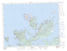
Maps showing Dildo Run Provincial Park, Twillingate, Newfoundland and Labrador
Dildo Run Provincial Park is a Conservation area located in Twillingate, Newfoundland and Labrador and has an elevation of 16 meters.
- Latitude: 49° 32' 8'' North (decimal: 49.5355555)
- Longitude: 54° 43' 19'' West (decimal: -54.7219444)
- Topography Feature Category: Conservation area
- Geographical Feature: Provincial Park
- Canadian Province/Territory: Newfoundland and Labrador
- Elevation: 16 meters
- Location: Twillingate
- Atlas of Canada Locator Map: Dildo Run Provincial Park
- GPS Coordinate Locator Map: Dildo Run Provincial Park Lat/Long
Dildo Run Provincial Park NTS Map Sheets