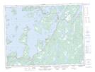
Maps showing Indian Cove Neck Provincial Park, Lewisporte, Newfoundland and Labrador
Indian Cove Neck Provincial Park is a Conservation area located in Lewisporte, Newfoundland and Labrador and has an elevation of 2 meters.
- Latitude: 49° 20' 30'' North (decimal: 49.3416666)
- Longitude: 54° 52' 12'' West (decimal: -54.8700000)
- Topography Feature Category: Conservation area
- Geographical Feature: Provincial Park
- Canadian Province/Territory: Newfoundland and Labrador
- Elevation: 2 meters
- Location: Lewisporte
- GPS Coordinate Locator Map: Indian Cove Neck Provincial Park Lat/Long
Indian Cove Neck Provincial Park NTS Map Sheets