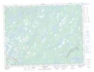
Maps showing Jonathan's Pond Provincial Park, Gander; Fogo, Newfoundland and Labrador
Jonathan's Pond Provincial Park is a Conservation area located in Gander; Fogo, Newfoundland and Labrador and has an elevation of 51 meters.
- Latitude: 49° 3' 14'' North (decimal: 49.0538888)
- Longitude: 54° 34' 56'' West (decimal: -54.5822222)
- Topography Feature Category: Conservation area
- Geographical Feature: Provincial Park
- Canadian Province/Territory: Newfoundland and Labrador
- Elevation: 51 meters
- Location: Gander; Fogo
- Atlas of Canada Locator Map: Jonathan's Pond Provincial Park
- GPS Coordinate Locator Map: Jonathan's Pond Provincial Park Lat/Long
Jonathan's Pond Provincial Park NTS Map Sheets