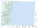
Maps showing La Manche Provincial Park, Ferryland, Newfoundland and Labrador
La Manche Provincial Park is a Conservation area located in Ferryland, Newfoundland and Labrador and has an elevation of 60 meters.
- Latitude: 47° 10' 44'' North (decimal: 47.1788888)
- Longitude: 52° 53' 25'' West (decimal: -52.8902777)
- Topography Feature Category: Conservation area
- Geographical Feature: Provincial Park
- Canadian Province/Territory: Newfoundland and Labrador
- Elevation: 60 meters
- Location: Ferryland
- Atlas of Canada Locator Map: La Manche Provincial Park
- GPS Coordinate Locator Map: La Manche Provincial Park Lat/Long
La Manche Provincial Park NTS Map Sheets