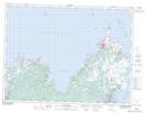
Maps showing Maberly Provincial Park, Bonavista South, Newfoundland and Labrador
Maberly Provincial Park is a Conservation area located in Bonavista South, Newfoundland and Labrador and has an elevation of 12 meters.
- Latitude: 48° 37' 28'' North (decimal: 48.6244444)
- Longitude: 53° 0' 58'' West (decimal: -53.0161111)
- Topography Feature Category: Conservation area
- Geographical Feature: Provincial Park
- Canadian Province/Territory: Newfoundland and Labrador
- Elevation: 12 meters
- Location: Bonavista South
- GPS Coordinate Locator Map: Maberly Provincial Park Lat/Long
Maberly Provincial Park NTS Map Sheets