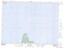
Maps showing Marine Drive Provincial Park, St. John's East Extern, Newfoundland and Labrador
Marine Drive Provincial Park is a Conservation area located in St. John's East Extern, Newfoundland and Labrador and has an elevation of 195 meters.
- Latitude: 47° 45' 5'' North (decimal: 47.7513888)
- Longitude: 52° 48' 26'' West (decimal: -52.8072222)
- Topography Feature Category: Conservation area
- Geographical Feature: Provincial Park
- Canadian Province/Territory: Newfoundland and Labrador
- Elevation: 195 meters
- Location: St. John's East Extern
- Atlas of Canada Locator Map: Marine Drive Provincial Park
- GPS Coordinate Locator Map: Marine Drive Provincial Park Lat/Long
Marine Drive Provincial Park NTS Map Sheets