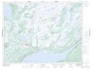
Maps showing Mary March Provincial Park, Windsor-Buchans, Newfoundland and Labrador
Mary March Provincial Park is a Conservation area located in Windsor-Buchans, Newfoundland and Labrador and has an elevation of 188 meters.
- Latitude: 48° 49' 58'' North (decimal: 48.8327777)
- Longitude: 56° 31' 54'' West (decimal: -56.5316666)
- Topography Feature Category: Conservation area
- Geographical Feature: Provincial Park
- Canadian Province/Territory: Newfoundland and Labrador
- Elevation: 188 meters
- Location: Windsor-Buchans
- GPS Coordinate Locator Map: Mary March Provincial Park Lat/Long
Mary March Provincial Park NTS Map Sheets