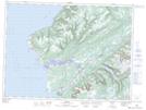
Maps showing Mummichog Provincial Park, St. George's, Newfoundland and Labrador
Mummichog Provincial Park is a Conservation area located in St. George's, Newfoundland and Labrador and has an elevation of 1 meters.
- Latitude: 47° 45' 44'' North (decimal: 47.7622222)
- Longitude: 59° 16' 57'' West (decimal: -59.2824999)
- Topography Feature Category: Conservation area
- Geographical Feature: Provincial Park
- Canadian Province/Territory: Newfoundland and Labrador
- Elevation: 1 meters
- Location: St. George's
- GPS Coordinate Locator Map: Mummichog Provincial Park Lat/Long
Mummichog Provincial Park NTS Map Sheets