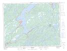
Maps showing Notre Dame Provincial Park, Lewisporte, Newfoundland and Labrador
Notre Dame Provincial Park is a Conservation area located in Lewisporte, Newfoundland and Labrador and has an elevation of 70 meters.
- Latitude: 49° 6' 58'' North (decimal: 49.1161111)
- Longitude: 55° 5' 11'' West (decimal: -55.0863888)
- Topography Feature Category: Conservation area
- Geographical Feature: Provincial Park
- Canadian Province/Territory: Newfoundland and Labrador
- Elevation: 70 meters
- Location: Lewisporte
- Atlas of Canada Locator Map: Notre Dame Provincial Park
- GPS Coordinate Locator Map: Notre Dame Provincial Park Lat/Long