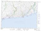
Maps showing Otter Bay Provincial Park, La Poile, Newfoundland and Labrador
Otter Bay Provincial Park is a Conservation area located in La Poile, Newfoundland and Labrador and has an elevation of 49 meters.
- Latitude: 47° 36' 58'' North (decimal: 47.6161111)
- Longitude: 58° 55' 13'' West (decimal: -58.9202777)
- Topography Feature Category: Conservation area
- Geographical Feature: Provincial Park
- Canadian Province/Territory: Newfoundland and Labrador
- Elevation: 49 meters
- Location: La Poile
- GPS Coordinate Locator Map: Otter Bay Provincial Park Lat/Long
Otter Bay Provincial Park NTS Map Sheets