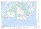
Maps showing Pistolet Bay Provincial Park, Strait of Belle Isle, Newfoundland and Labrador
Pistolet Bay Provincial Park is a Conservation area located in Strait of Belle Isle, Newfoundland and Labrador and has an elevation of 35 meters.
- Latitude: 51° 32' 00'' North (decimal: 51.5333333)
- Longitude: 55° 40' 56'' West (decimal: -55.6822222)
- Topography Feature Category: Conservation area
- Geographical Feature: Provincial Park
- Canadian Province/Territory: Newfoundland and Labrador
- Elevation: 35 meters
- Location: Strait of Belle Isle
- Atlas of Canada Locator Map: Pistolet Bay Provincial Park
- GPS Coordinate Locator Map: Pistolet Bay Provincial Park Lat/Long
Pistolet Bay Provincial Park NTS Map Sheets