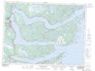
Maps showing Smith Sound Provincial Park, Trinity North, Newfoundland and Labrador
Smith Sound Provincial Park is a Conservation area located in Trinity North, Newfoundland and Labrador and has an elevation of 14 meters.
- Latitude: 48° 13' 32'' North (decimal: 48.2255555)
- Longitude: 53° 54' 42'' West (decimal: -53.9116666)
- Topography Feature Category: Conservation area
- Geographical Feature: Provincial Park
- Canadian Province/Territory: Newfoundland and Labrador
- Elevation: 14 meters
- Location: Trinity North
- GPS Coordinate Locator Map: Smith Sound Provincial Park Lat/Long
Smith Sound Provincial Park NTS Map Sheets