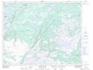
Maps showing Three Mile Lake Provincial Park, St. Barbe, Newfoundland and Labrador
Three Mile Lake Provincial Park is a Conservation area located in St. Barbe, Newfoundland and Labrador and has an elevation of 86 meters.
- Latitude: 50° 59' 40'' North (decimal: 50.9944444)
- Longitude: 56° 51' 47'' West (decimal: -56.8630555)
- Topography Feature Category: Conservation area
- Geographical Feature: Provincial Park
- Canadian Province/Territory: Newfoundland and Labrador
- Elevation: 86 meters
- Location: St. Barbe
- GPS Coordinate Locator Map: Three Mile Lake Provincial Park Lat/Long
Three Mile Lake Provincial Park NTS Map Sheets