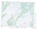
Maps showing Long Marsh, Ferryland, Newfoundland and Labrador
Long Marsh is a Valley located in Ferryland, Newfoundland and Labrador and has an elevation of 73 meters.
- Latitude: 46° 48' 22'' North (decimal: 46.8061111)
- Longitude: 53° 23' 43'' West (decimal: -53.3952777)
- Topography Feature Category: Valley
- Geographical Feature: Valley
- Canadian Province/Territory: Newfoundland and Labrador
- Elevation: 73 meters
- Location: Ferryland
- Atlas of Canada Locator Map: Long Marsh
- GPS Coordinate Locator Map: Long Marsh Lat/Long
Long Marsh NTS Map Sheets