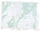
Maps showing Little Stoney Ridge, St. Mary's-The Capes, Newfoundland and Labrador
Little Stoney Ridge is a Mountain located in St. Mary's-The Capes, Newfoundland and Labrador and has an elevation of 212 meters.
- Latitude: 46° 56' 30'' North (decimal: 46.9416666)
- Longitude: 53° 19' 51'' West (decimal: -53.3308333)
- Topography Feature Category: Mountain
- Geographical Feature: Ridge
- Canadian Province/Territory: Newfoundland and Labrador
- Elevation: 212 meters
- Location: St. Mary's-The Capes
- Atlas of Canada Locator Map: Little Stoney Ridge
- GPS Coordinate Locator Map: Little Stoney Ridge Lat/Long
Little Stoney Ridge NTS Map Sheets