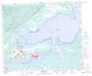
Maps showing Man o'War Island, Naskaupi, Newfoundland and Labrador
Man o'War Island is a Island located in Naskaupi, Newfoundland and Labrador and has an elevation of 12 meters.
- Latitude: 53° 18' 16'' North (decimal: 53.3044444)
- Longitude: 60° 14' 15'' West (decimal: -60.2374999)
- Topography Feature Category: Island
- Geographical Feature: Island
- Canadian Province/Territory: Newfoundland and Labrador
- Elevation: 12 meters
- Location: Naskaupi
- Atlas of Canada Locator Map: Man o'War Island
- GPS Coordinate Locator Map: Man o'War Island Lat/Long
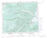
Man o'War Island NTS Map Sheets