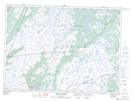
Maps showing Little Juniper Break, Ferryland, Newfoundland and Labrador
Little Juniper Break is a Valley located in Ferryland, Newfoundland and Labrador and has an elevation of 181 meters.
- Latitude: 46° 54' 38'' North (decimal: 46.9105555)
- Longitude: 53° 15' 50'' West (decimal: -53.2638888)
- Topography Feature Category: Valley
- Geographical Feature: Pass
- Canadian Province/Territory: Newfoundland and Labrador
- Elevation: 181 meters
- Location: Ferryland
- Atlas of Canada Locator Map: Little Juniper Break
- GPS Coordinate Locator Map: Little Juniper Break Lat/Long
Little Juniper Break NTS Map Sheets