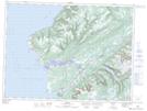
Maps showing Benoits Siding, St. George's, Newfoundland and Labrador
Benoits Siding is a Unincorporated area located in St. George's, Newfoundland and Labrador and has an elevation of 29 meters.
- Latitude: 47° 52' 5'' North (decimal: 47.8680555)
- Longitude: 59° 7' 3'' West (decimal: -59.1174999)
- Topography Feature Category: Unincorporated area
- Geographical Feature: Settlement
- Canadian Province/Territory: Newfoundland and Labrador
- Elevation: 29 meters
- Location: St. George's
- Atlas of Canada Locator Map: Benoits Siding
- GPS Coordinate Locator Map: Benoits Siding Lat/Long
Benoits Siding NTS Map Sheets