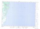
Maps showing Gully Marsh, Ferryland, Newfoundland and Labrador
Gully Marsh is a Low vegetation located in Ferryland, Newfoundland and Labrador.
- Latitude: 46° 58' 54'' North (decimal: 46.9816666)
- Longitude: 52° 55' 57'' West (decimal: -52.9325000)
- Topography Feature Category: Low vegetation
- Geographical Feature: Marsh
- Canadian Province/Territory: Newfoundland and Labrador
- Location: Ferryland
- Atlas of Canada Locator Map: Gully Marsh
- GPS Coordinate Locator Map: Gully Marsh Lat/Long