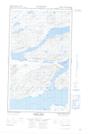
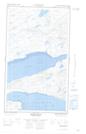
Maps showing Little Pot Cove, Torngat Mountains, Newfoundland and Labrador
Little Pot Cove is a Bay located in Torngat Mountains, Newfoundland and Labrador and has an elevation of 6 meters.
- Latitude: 54° 2' 19'' North (decimal: 54.0386801)
- Longitude: 58° 37' 18'' West (decimal: -58.6215482)
- Topography Feature Category: Bay
- Geographical Feature: Cove
- Canadian Province/Territory: Newfoundland and Labrador
- Elevation: 6 meters
- Location: Torngat Mountains
- Atlas of Canada Locator Map: Little Pot Cove
- GPS Coordinate Locator Map: Little Pot Cove Lat/Long
Little Pot Cove NTS Map Sheets