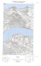
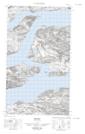
Maps showing Sand Banks, Eagle River, Newfoundland and Labrador
Sand Banks is a Shoal located in Eagle River, Newfoundland and Labrador.
- Latitude: 54° 10' 21'' North (decimal: 54.1726087)
- Longitude: 58° 23' 30'' West (decimal: -58.3917963)
- Topography Feature Category: Shoal
- Geographical Feature: Sand Banks / Sandbanks
- Canadian Province/Territory: Newfoundland and Labrador
- Location: Eagle River
- Atlas of Canada Locator Map: Sand Banks
- GPS Coordinate Locator Map: Sand Banks Lat/Long
Sand Banks NTS Map Sheets