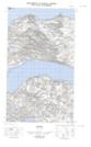
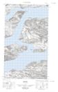
Maps showing Indian Point, Eagle River, Newfoundland and Labrador
Indian Point is a Cape located in Eagle River, Newfoundland and Labrador.
- Latitude: 54° 5' 6'' North (decimal: 54.0850300)
- Longitude: 58° 11' 21'' West (decimal: -58.1891149)
- Topography Feature Category: Cape
- Geographical Feature: Point
- Canadian Province/Territory: Newfoundland and Labrador
- Location: Eagle River
- Atlas of Canada Locator Map: Indian Point
- GPS Coordinate Locator Map: Indian Point Lat/Long
Indian Point NTS Map Sheets