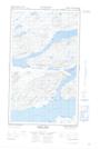
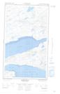
Maps showing Peter Lewis Island, Eagle River, Newfoundland and Labrador
Peter Lewis Island is a Island located in Eagle River, Newfoundland and Labrador.
- Latitude: 54° 0' 6'' North (decimal: 54.0015653)
- Longitude: 58° 35' 28'' West (decimal: -58.5911173)
- Topography Feature Category: Island
- Geographical Feature: Island
- Canadian Province/Territory: Newfoundland and Labrador
- Location: Eagle River
- Atlas of Canada Locator Map: Peter Lewis Island
- GPS Coordinate Locator Map: Peter Lewis Island Lat/Long
Peter Lewis Island NTS Map Sheets