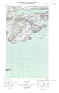
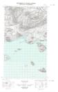
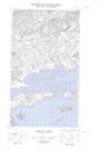
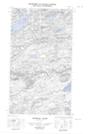
Maps showing Corner Brook, Torngat Mountains, Newfoundland and Labrador
Corner Brook is a River located in Torngat Mountains, Newfoundland and Labrador.
- Latitude: 54° 23' 6'' North (decimal: 54.3851177)
- Longitude: 58° 3' 46'' West (decimal: -58.0627971)
- Topography Feature Category: River
- Geographical Feature: Brook
- Canadian Province/Territory: Newfoundland and Labrador
- Location: Torngat Mountains
- Atlas of Canada Locator Map: Corner Brook
- GPS Coordinate Locator Map: Corner Brook Lat/Long
Corner Brook NTS Map Sheets
013I05E Pottles Bay Topographic Map at 1:50,000 scale
013I05W Pottles Bay Topographic Map at 1:50,000 scale
013J08E Ticoralak Island Topographic Map at 1:50,000 scale
013J08W Ticoralak Island Topographic Map at 1:50,000 scale
013I Groswater Bay Topographic Map at 1:250,000 scale
013J Rigolet Topographic Map at 1:250,000 scale
013I05W Pottles Bay Topographic Map at 1:50,000 scale
013J08E Ticoralak Island Topographic Map at 1:50,000 scale
013J08W Ticoralak Island Topographic Map at 1:50,000 scale
013I Groswater Bay Topographic Map at 1:250,000 scale
013J Rigolet Topographic Map at 1:250,000 scale