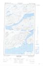
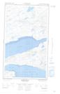
Maps showing Middle House Point, Torngat Mountains, Newfoundland and Labrador
Middle House Point is a Cape located in Torngat Mountains, Newfoundland and Labrador.
- Latitude: 54° 11' 37'' North (decimal: 54.1934866)
- Longitude: 58° 35' 13'' West (decimal: -58.5868992)
- Topography Feature Category: Cape
- Geographical Feature: Point
- Canadian Province/Territory: Newfoundland and Labrador
- Location: Torngat Mountains
- Atlas of Canada Locator Map: Middle House Point
- GPS Coordinate Locator Map: Middle House Point Lat/Long
Middle House Point NTS Map Sheets