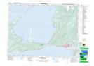
Maps showing Kippens, Port au Port, Newfoundland and Labrador
Kippens is a Town located in Port au Port, Newfoundland and Labrador and has an elevation of 25 meters.
- Latitude: 48° 33' 31'' North (decimal: 48.5585444)
- Longitude: 58° 38' 2'' West (decimal: -58.6339833)
- Topography Feature Category: Town
- Geographical Feature: Town
- Canadian Province/Territory: Newfoundland and Labrador
- Elevation: 25 meters
- Location: Port au Port
- Atlas of Canada Locator Map: Kippens
- GPS Coordinate Locator Map: Kippens Lat/Long
Kippens NTS Map Sheets