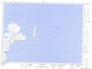
Maps showing Bunny Brook, Trinity-Bay de Verde, Newfoundland and Labrador
Bunny Brook is a River located in Trinity-Bay de Verde, Newfoundland and Labrador.
- Latitude: 48° 4' 27'' North (decimal: 48.0741666)
- Longitude: 52° 57' 2'' West (decimal: -52.9505555)
- Topography Feature Category: River
- Geographical Feature: Brook
- Canadian Province/Territory: Newfoundland and Labrador
- Location: Trinity-Bay de Verde
- Atlas of Canada Locator Map: Bunny Brook
- GPS Coordinate Locator Map: Bunny Brook Lat/Long
Bunny Brook NTS Map Sheets