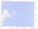
Maps showing John Millers Island, Trinity-Bay de Verde, Newfoundland and Labrador
John Millers Island is a Cape located in Trinity-Bay de Verde, Newfoundland and Labrador.
- Latitude: 48° 6' 20'' North (decimal: 48.1055555)
- Longitude: 52° 51' 5'' West (decimal: -52.8513888)
- Topography Feature Category: Cape
- Geographical Feature: Point
- Canadian Province/Territory: Newfoundland and Labrador
- Location: Trinity-Bay de Verde
- Atlas of Canada Locator Map: John Millers Island
- GPS Coordinate Locator Map: John Millers Island Lat/Long
John Millers Island NTS Map Sheets