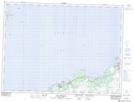
Maps showing Gaze Hill, Trinity-Bay de Verde, Newfoundland and Labrador
Gaze Hill is a Mountain located in Trinity-Bay de Verde, Newfoundland and Labrador and has an elevation of 85 meters.
- Latitude: 48° 2' 14'' North (decimal: 48.0372222)
- Longitude: 53° 11' 10'' West (decimal: -53.1861111)
- Topography Feature Category: Mountain
- Geographical Feature: Hill
- Canadian Province/Territory: Newfoundland and Labrador
- Elevation: 85 meters
- Location: Trinity-Bay de Verde
- Atlas of Canada Locator Map: Gaze Hill
- GPS Coordinate Locator Map: Gaze Hill Lat/Long
Gaze Hill NTS Map Sheets